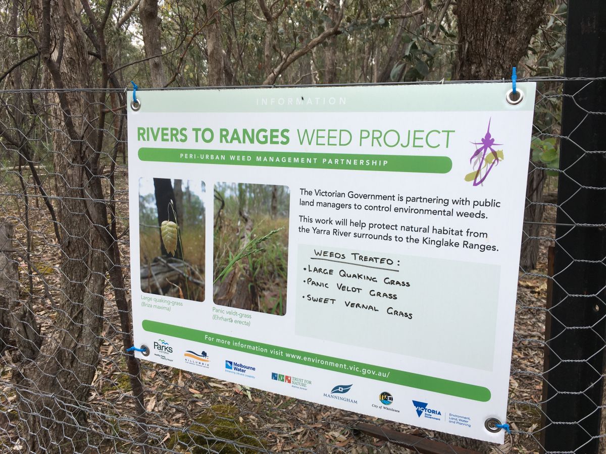
Weeds in the peri-urban environment
Melbourne’s peri-urban areas contain important habitat and biodiversity. In a rapidly changing and fragmented landscape, land managers face many challenges to protect native plants, animals and fungi.
Weeds impact the diversity and function of natural habitats, land productivity, water quality, tourism, fire risk and visual amenity values. Management of weeds throughout the peri-urban area is a challenge and requires collaboration between land managers and stakeholders on both public and private land.
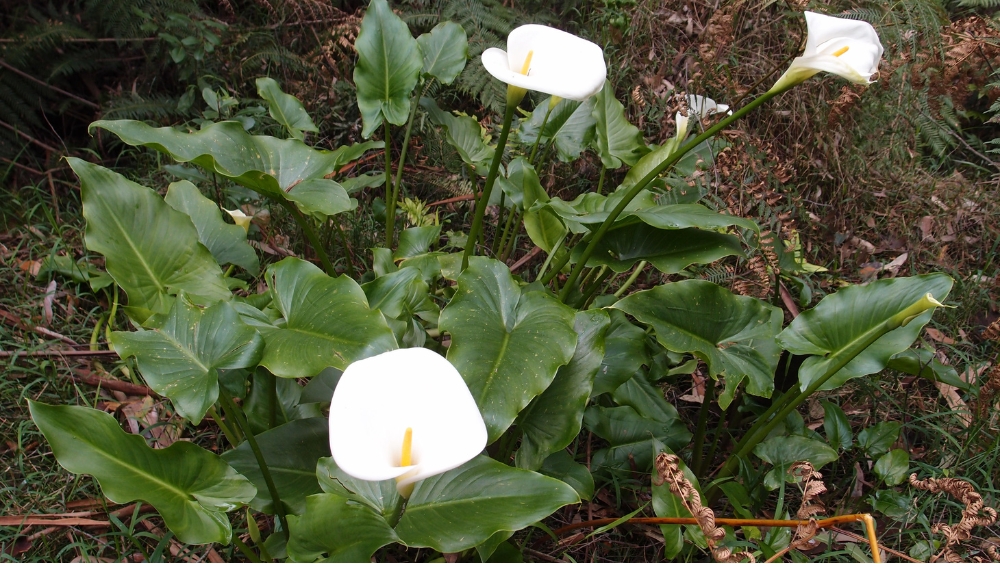
Arum lily (Zantedeschia aethiopica) a commonly found weed in Melbourne’s peri-urban environment. Photo by Bec Schwinghammer.
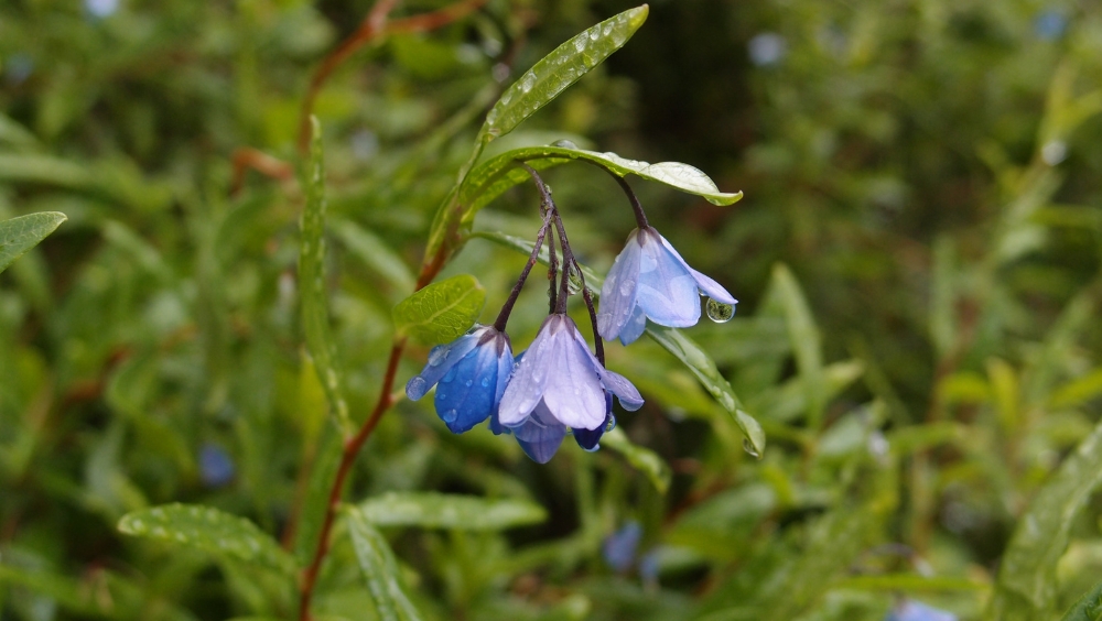
Bluebell Creeper (Billardiera heterophylla), another commonly found weed species in Melbourne’s peri-urban environment. Photo by Bec Schwinghammer.
Our program
The PWMP program is a collaborative initiative between state and local governments, public land managers, Traditional Owners and the community. It is aimed at safeguarding native plant and animal species from invasive weeds in the peri-urban fringe area of Melbourne. With a funding allocation of $1.7 million until June 2027, the program supports a total of nine projects to engage with local communities and deliver weed control in over 5,000 hectares.
Building upon the accomplishments and previous investments of the PWMP initiative, the program focuses on identifying native habitats of significant environmental and community value on public land. Land managers, such as Councils, Parks Victoria and Traditional Owner groups, work closely with the community to prevent and reduce impacts of high-risk weeds in key council areas surrounding Melbourne.
Supporting Biodiversity 2037
The PWMP program is part of the Victorian Government’s ongoing investment to support the implementation of Protecting Victoria’s Environment – Biodiversity 2037. It is one of a suite of programs funding actions to support biodiversity and threatened species.
Current projects
This map shows Melbourne's peri-urban councils and projects funded through the Peri-urban Weed Management Partnerships program.
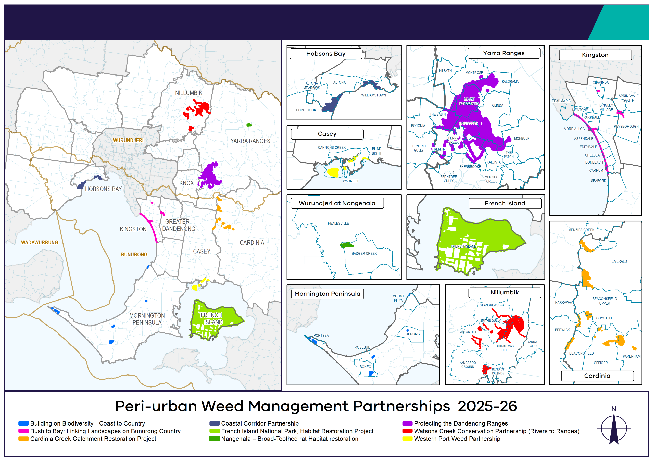
Details on the 9 projects
The Building on Biodiversity – Coast to Country project is a partnership between the Mornington Peninsula Shire, Bunurong Land Council Aboriginal Corporation, Parks Victoria and Local Community Groups, delivering on-ground Environmental Weed control at high biodiversity value sites. This project will enhance the remnant bushland of Arthurs Seat State Park, Devilbend Natural Features Reserve, Mornington Peninsula National Park and Point Nepean National Park. Works focus on environmental weed control to restore threatened vegetation communities and habitat for listed species such as the Swamp Skink, Southern Toadlet, White-footed Dunnart, and Powerful Owl.
Bush to Bay: Linking Landscapes on Bunurong Country is a collaborative project between Kingston City Council, City of Greater Dandenong and Bunurong Land Council Aboriginal Corporation. Management efforts will focus on weed suppression along our sensitive coastal sand dune ecosystems, as well as at culturally significant sites. The project will provide local community groups and volunteers an opportunity to work alongside the Bunurong Strong Country Rangers and Council Conservation Officers to undertake weed control, revegetation, and cultural education activities. The foreshore hosts several unique species and threatened habitat’s, including remnant Coastal Dune Grassland, Coastal Dune Scrub, Coastal Headland Scrub, Sand Heathland and Coast Banksia Woodlands. The collaborative project aims to protect and enhance biodiversity by combining targeted weed reduction, promotion of indigenous species, and conservation with cultural knowledge.
The Cardinia Shire Council in partnership with Parks Victoria, Melbourne Water, Bunurong Land Council Aboriginal Corporation, and the Friends of Cardinia Creek and Lysterfield Park community groups will enhance and restore native habitat by reducing high threat weeds along Cardinia Creek and the adjacent reserves. This work will help support the Critically Endangered Helmeted Honeyeater that was recently reintroduced into the Cardinia Creek Project Area.
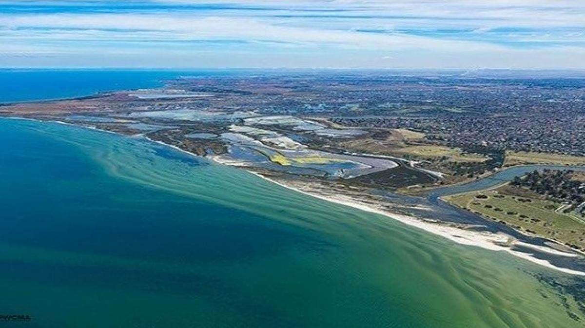
Hobsons Bay is home to some incredibly important areas for biodiversity, including coastal vegetation and mudflats, which provide feeding, roosting and nesting areas for critically endangered migratory wading birds and local shorebirds. The Coastal Corridor Partnership project aims to reduce habitat-altering woody weeds (e.g. Boxthorn) and invasive grasses (e.g. Serrated Tussock), continuing the strong partnership between the Hobsons Bay City Council, Parks Victoria, the Bunurong Land Council Aboriginal Corporation, and local Friends of Groups.
French Island National Park, surrounded by the internationally significant Western Port Ramsar Site, is Victoria's largest island, hosting rich and diverse fauna and flora. The project focuses on two significant areas, Bluegums and Bullock Swamp. It aims to protect conservation assets, including threatened species like Eastern Barred Bandicoots and Long-nosed Potoroos, while enhancing habitats and native flora in Heathland, Dry Forest, Woodland, and Coastal ecosystems. Parks Victoria works with partner organisations to plan and deliver the work, including Bunurong Land Council Aboriginal Corporation, Friends of French Island, French Island Landcare, Zoos Victoria, Melbourne Water and DEECA.
Wurundjeri Woi-wurrung Cultural Heritage Aboriginal Corporation is leading a project to restore habitat at Barak Creek – adjoining Healesville Sanctuary – for the critically endangered Broad-Toothed Rat that was discovered in 2024. As well as being a site of environmental significance, Nangenala is a site of cultural significance to the Wurundjeri people. Wurundjeri’s Narrap unit in collaboration with Zoo's Victoria will reduce Burgan infestations to restore critical habitat for the Broad-toothed Rat.
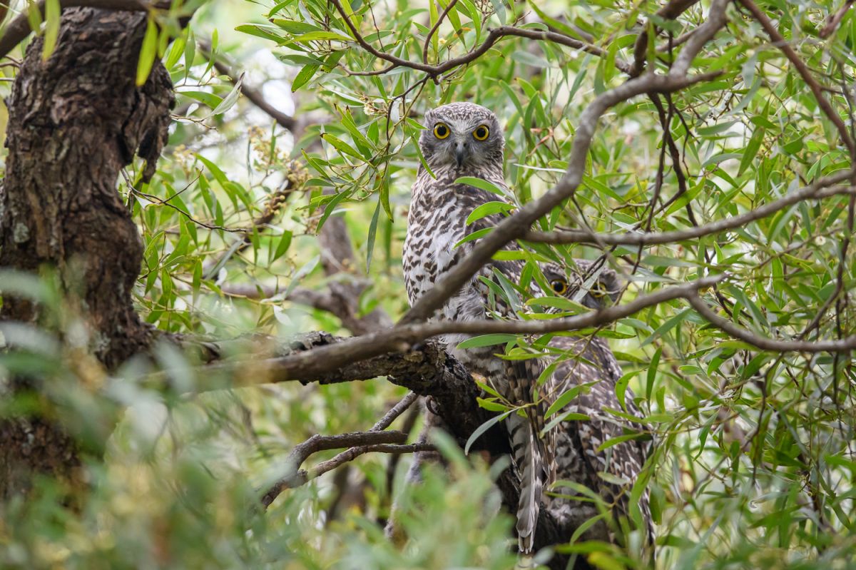
The Dandenong Ranges is home to a diverse range of vegetation communities, such as towering Mountain Ash trees and beautiful fern gullies. The area provides critical habitats for endangered species like Powerful Owls, Tree Goannas, and Southern Greater Gliders. This project targets weed species that have emerged following the 2021 storms event that reduced tree canopy cover and created significant ground disturbance. Weeds of greatest concern include Sweet Pittosporum, Sycamore Maple, Holly, English Ivy, and Blackberry. The project continues the strong partnership between the Yarra Ranges Council, Parks Victoria, Melbourne Water, Knox City Council and local environmental community groups.
The Watsons Creek Conservation Partnership is protecting over 1,000 hectares of Melbourne’s most intact remnant native vegetation. The areas included have high biodiversity values and are home to rare and threatened flora and fauna including various endangered native orchid species, Brush-tailed Phascogale, Slender-tailed Dunnart, Powerful Owl and Swift Parrot. The project continues the strong partnership between the Nillumbik Shire Council, Parks Victoria, Melbourne Water and local environmental community groups.
Located on the boundary of the Western Port Ramsar Site, with critical habitat supporting a host of national and state-listed flora and fauna species, this project is focusing on the protection of our sensitive mangrove ecosystems and bushland habitats. The project is mitigating the impact of invasive weeds within the Warneet Natural Features Reserve, Blind Bight Bushland Reserve, Quail Island and Chinaman Island. The City of Casey, in close collaboration with Parks Victoria and the Friends of Warneet, aim to enhance native species, and foster community engagement and education to promote the appreciation and protection of the reserves.
How can you help?
So you’re passionate about acting for nature? Check out the things you can do to stop the spread of weeds and allow our native plants and animals to thrive.
- Report new and unusual plant/weed sightings to Agriculture Victoria and on iNaturalist.
- Learn about weeds and join Weed Spotters Victoria for free. They have plenty of free online resources to help you identify weeds and know what they look like.
- Don’t spread weeds through the bush. Check your shoes after you go for a walk, to remove any seeds or plant matter - check your pets too! Practice good vehicle hygiene as they can hitch a ride there too.
- If you have a garden carefully consider what you plant, many of our environmental weeds start out in residential gardens. Consider planting Victorian native species indigenous to the Melbourne area. You can find some great native nurseries here .Practice responsible disposal of weeds when gardening.
- When you remove weeds remember to plant something else in its place. This way you’re more likely to keep the weeds out and your hard work won’t go to waste.
- Become involved in environmental volunteering in Victoria, join your local ‘Friends of’ group or Landcare group, or explore volunteer opportunities with the Parks Victoria tool, ParkConnect.
Page last updated: 28/07/25