Land cover and native vegetation mapping in Victoria
The newly developed Victorian Land Cover Time Series dataset provides valuable insights into land cover changes across the state.
It gives users a visual and analytical snapshot of the current and previous type of cover over different areas. That cover can include native forests, bushland, wetlands, farmland, land used for recreation, and built up areas, including towns and cities.
The extent of native vegetation is dynamic. The land cover dataset builds DELWP’s capacity to capture information of this nature, and to track changes in vegetation over time. Land cover information helps land managers:
- Better understand the way land is used and managed across Victoria,
- Improve the consistency, accuracy and repeatability of reporting on landscape scale change (a Biodiversity 2037 indicator, used in the State of the Environment 2018 report),
- Link with existing biodiversity tools and systems, and
- Help guide management actions for native vegetation and biodiversity programs, agriculture, forestry, carbon capture and storage and urban development.
A new framework for land cover mapping
The Land Cover Time Series approach to mapping is multi-disciplinary combining:
- Freely accessible remote sensed data,
- Advanced computing techniques and processing, and
- Existing ecological data and knowledge.
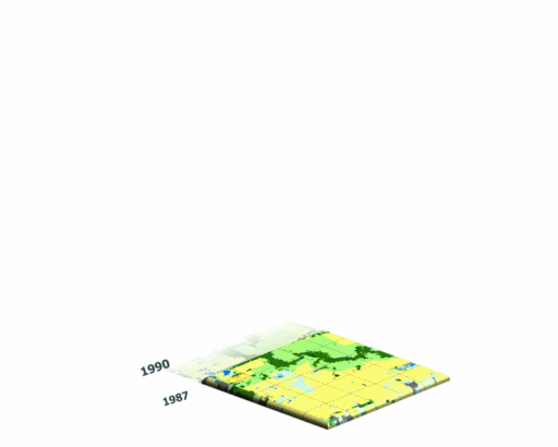
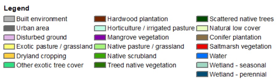
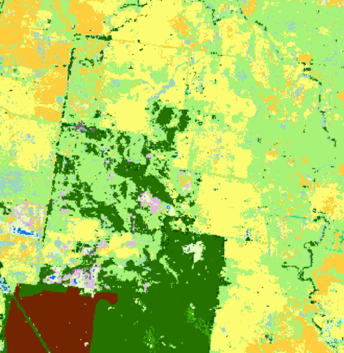
The dataset features spatial layers representing different time periods between 1987 and 2019. Each layer presents the most likely land cover class for that area. Victoria has 19 land cover classes. Each 25m pixel of the layers displays one of these classes.
Classes
The 19 target land cover classes include: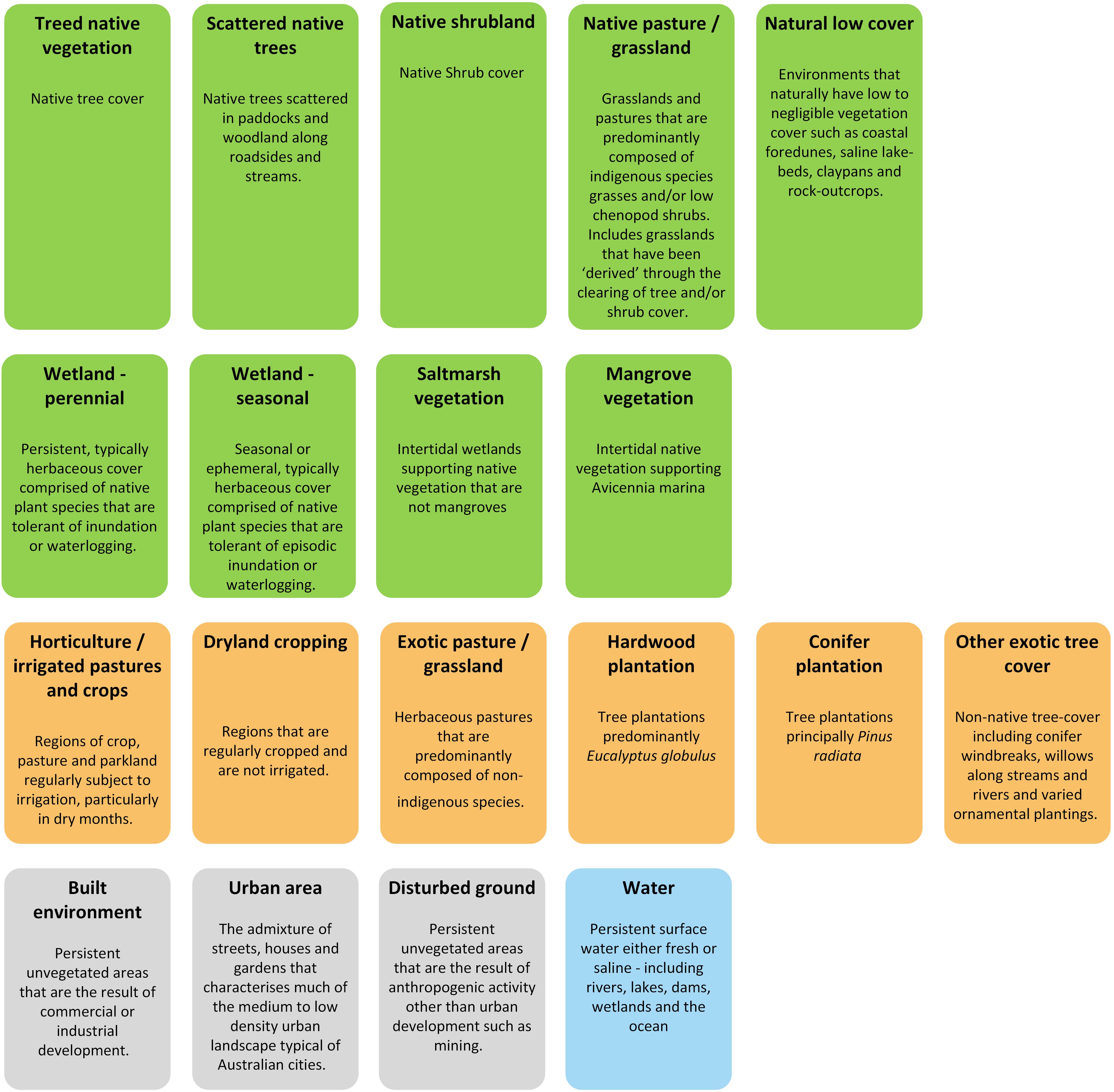
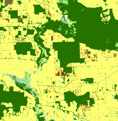
Grassland restoration
Native grassland restoration (light green) at Mount Rothwell
Dam to wetland transition
![]()
Wetland restoration (turquoise) through draining of Lake Mokoan (blue)
Urban growth
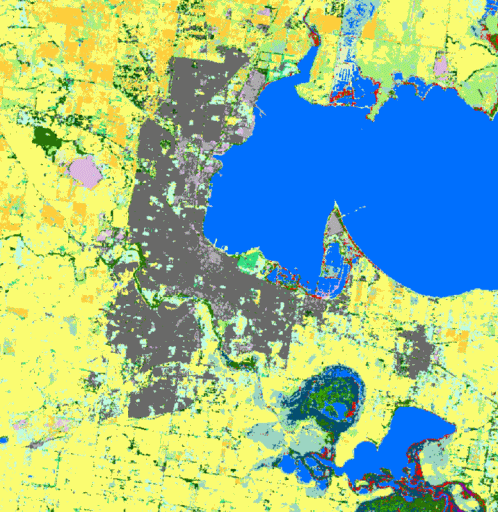
Urban and associated built up growth (grey) around Geelong
Hardwood plantations in the south-west
Increase in hardwood plantations (maroon) in Victoria's south-west
Accessing and viewing the data
The Victorian Land Cover Time Series datasets, methodologies and summary by location statistics (examples) can be accessed via the following links:
NatureKit - DEECA's biodiversity web mapping and reporting tool
DataShare - to download the land cover layers
Technical report (PDF, 3.0 MB) - for detailed information on the methodologies
Summary by location statistics (Excel, 5.9 MB) - Interactive excel table providing land cover change highlights across Catchment Management Authority areas, Bioregions, Local Government Areas and Registered Aboriginal Party areas
For further information contact: biodiversity.info@deeca.vic.gov.au
Page last updated: 30/06/25