Expanding parklands for communities in Melbourne’s outer northern suburbs.
On this page:
About the parklands
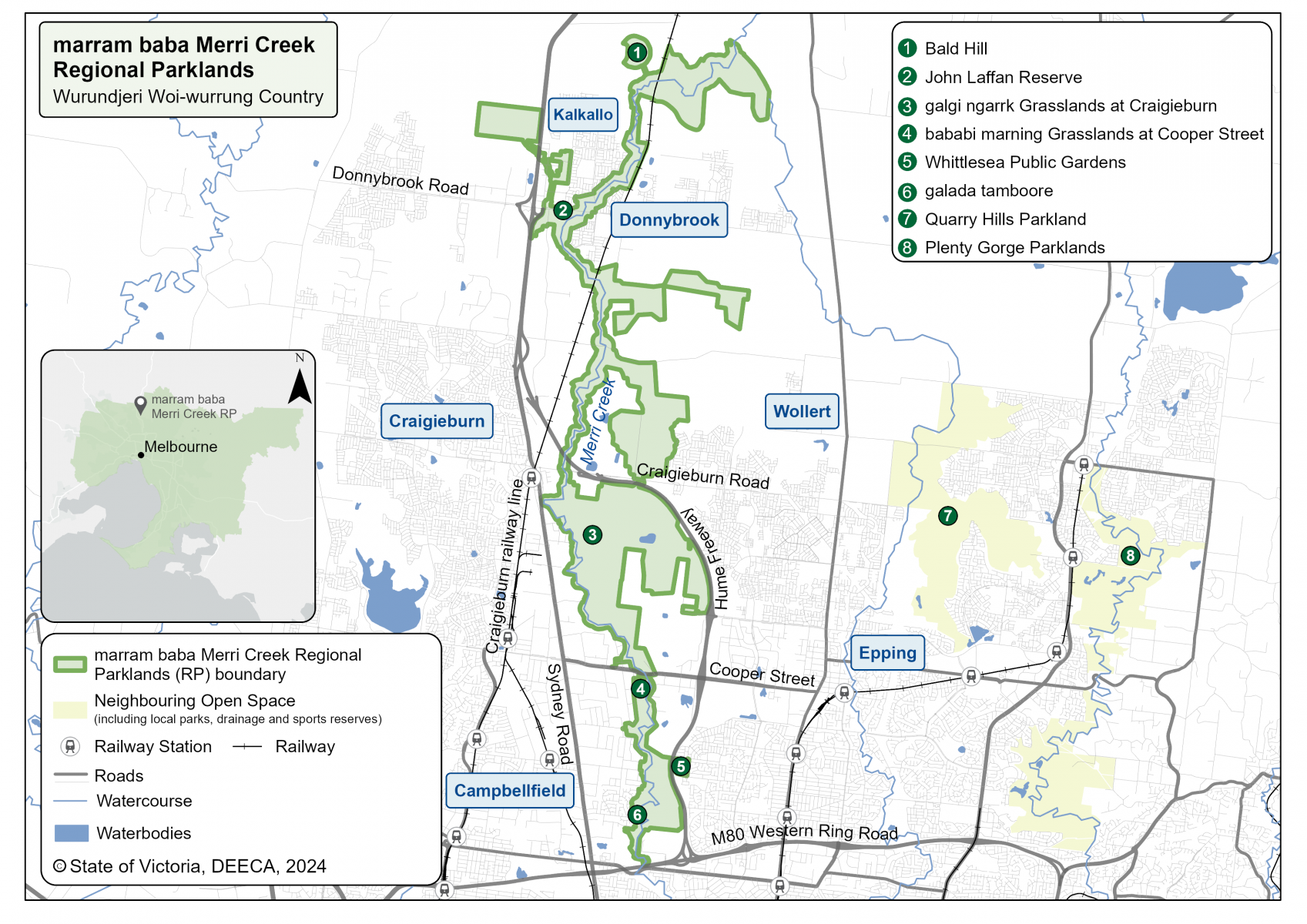
The marram baba / Merri Creek Regional Parklands will encompass, 2778-hectares of parkland from Campbellfield to Beveridge. The parklands will provide more green open space for communities in Melbourne’s growing north, protect plants and animals and strengthen cultural heritage.
The marram baba Merri Creek Regional Parklands Future Directions Plan 2023 ensures the expanded parklands will protect new areas of biodiversity value and cultural heritage and include new facilities to support community health and wellbeing including walking, cycling, trails, viewing platforms and picnic areas. The Plan will guide the gradual expansion of the parklands until 2050.
Traditional Owners of the land, the Wurundjeri
Woi-wurrung people, refer to the land as marram baba meaning 'body of mother'.
Where will the parklands be located?
The expanded parklands will run along Merri Creek on Wurundjeri Woi-wurrung Country, about 30 kilometres north of Melbourne’s CBD. The marram baba Merri Creek Regional Parklands will encompass more than 2,700 hectares from Campbellfield to Beveridge.
The parklands will establish new links between existing open space including galada tamboore, galgi ngarrk Grasslands at Craigieburn, bababi marning Grasslands at Cooper Street, Whittlesea Public Gardens, John Laffan Reserve at Donnybrook, and connecting Kalkallo and Curly Sedge Creeks.
When completed, the parklands will be among the biggest in Melbourne and expand the Merri Creek path that begins at the junction with the Yarra River.
Some areas of the parklands are not accessible to the public due to conservation and cultural sensitivities.
marram baba / Merri Creek Regional Parklands map
Enjoy these parkland areas
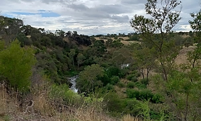
Formed by the erosion of the volcanic plain by Merri Creek over a million years ago, the landscape of galada tamboore encompasses basalt escarpments with Merri Creek flowing through its centre. The name galada tamboore means ‘creek waterhole’ in Wurundjeri Woi-wurrung language and is culturally significant for the Wurundjeri Woi-wurrung people.
Located just north of the Metropolitan Ring Road in Campbellfield, this 130-ha reserve is a site of biodiversity significance that has important riparian scrub, significant grasslands, and wildlife. It also supplies an important function as a natural flood retarding basin.
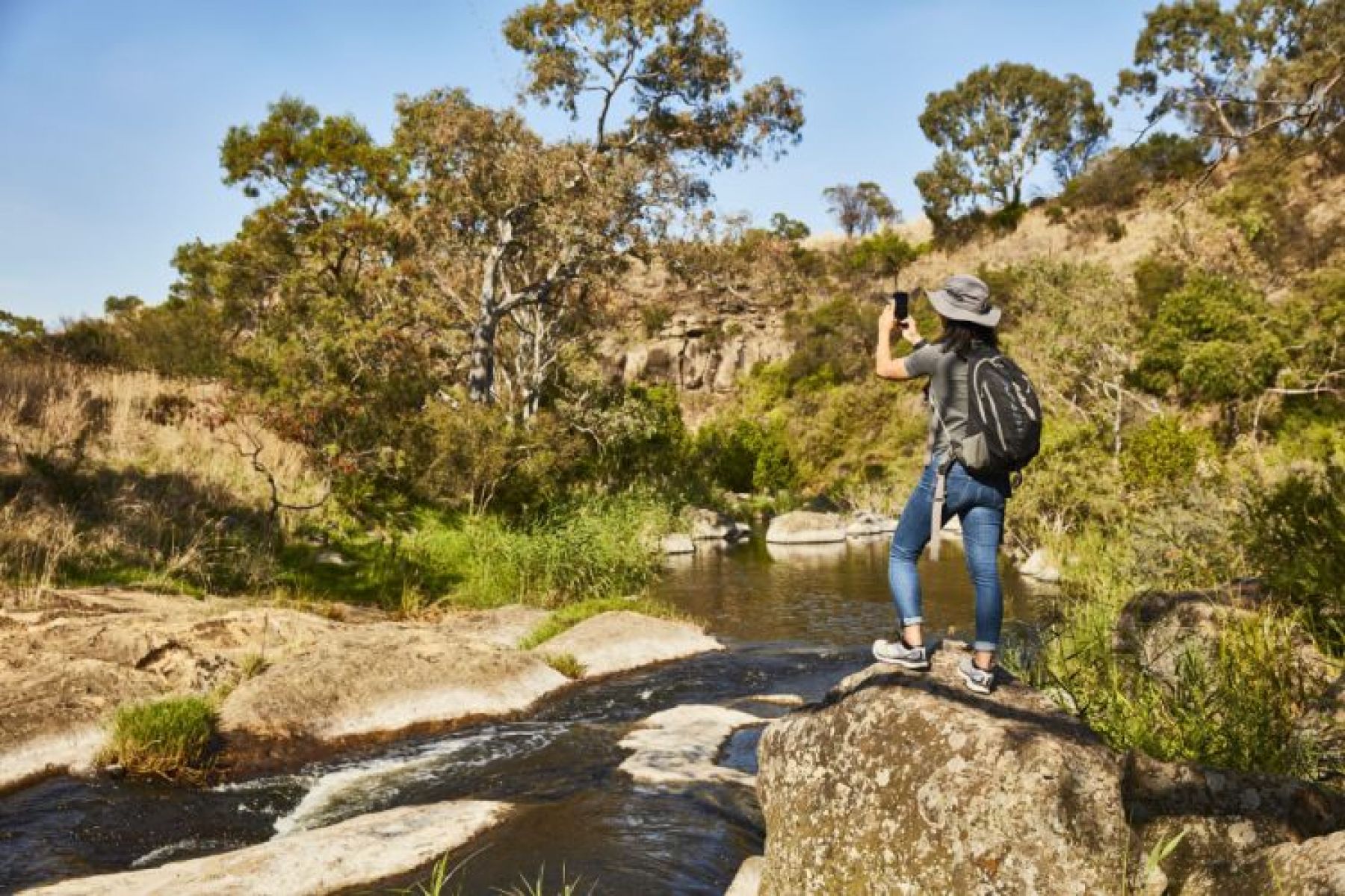
The community can experience parts of the reserve via the Merri Creek Trail with opportunities for exercise, play, relaxation, views, and nature appreciation. Access to galada tamboore from Campbellfield is through the Horne Street Picnic Area, Somerset Drive, Hattie Court Playground, Barry Road, and Merri Concourse. Another way to enter is via the Whittlesea Public Gardens in Lalor.
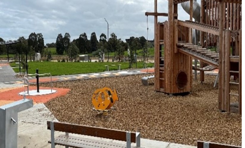
Located in Lalor on Barry Road, the Whittlesea Public Gardens provide over 14 ha of open space for active and passive recreation.
Recent redevelopment of the gardens includes a new playground, nature play areas and a dedicated learn-to-ride area for cyclists. Future upgrades will mean visitors can also enjoy a new skate park, basketball courts, rock climbing wall and outdoor fitness equipment.
Whittlesea Public Gardens provide a major gateway into marram baba for people living in Whittlesea and is a launching place for cycling on the galada tamboore shared path east of the Hume Freeway. Walking and cycling trails in the gardens connect to the grasslands of galada tamboore, the galada tamboore reserve and the Merri Creek Trail by crossing the iconic ‘Ned Kelly Bridge’ over the Hume Freeway.
Located south of Cooper Street, bababi marning (previously known as the Cooper Street Grasslands) is a nature conservation reserve that protects nationally and state significant native plains grassland. The name bababi marning means ‘mother’s hand’ in Wurundjeri Woi-wurrung language and is culturally significant for the Wurundjeri Woi-wurrung people.
The 50-ha reserve protects critically endangered grasslands and areas of high-value escarpment shrubland and Woolly Tea-tree riparian scrub, supplying habitat for the nationally significant Golden Sun Moth and Striped Legless Lizard. bababi marning is also home to several important animal species including the Mistletoe Bird, Stubble Quail, Latham’s Snipe, Tawny Frogmouth, Short-beaked Echidna, Swamp Wallaby, Eastern Grey Kangaroo, Blue-Tongue Lizard and Spotted Marsh Frog.
bababi marning has restricted access to protect its high conservation values, but visitors are welcome to enjoy the adjacent Metrolink Circuit Reserve (image below) managed by Hume City Council.
Located primarily on the east of Merri Creek, galgi ngarrk (previously known as Craigieburn Grasslands), is the largest reserve within the Parklands and encompasses approximately 400 ha of nationally and state significant native grasslands. The name galgi ngarrk means ‘back bone’ in Wurundjeri Woi-wurrung language and is culturally significant to the Wurundjeri Woi-wurrung people.
The reserve includes remnant stony knoll grasslands and supplies habitat for protected plants, animals, and migratory birds, including nationally and state significant endangered species such as the Matted Flax Lily, Curly Sedge, Striped Legless Lizard, Plains Wanderer, Golden Sun Moth, and Growling Grass Frog.
Northpark Nature Reserve is located on Northpark Drive and provides an open space link and walking trail with views of Merri Creek and low escarpments. Wildlife connections under the Cooper Street bridge link this reserve to the bababi marning grasslands.
Most of the reserve encompasses sloping grassed areas, rocky escarpments and minor riverine landforms associated with Merri Creek. The trail provides an enjoyable respite in a light industrial area with seating and views along the creek.
The 14-ha site has conservation value with Golden Sun Moth and Growling Grass Frog having been recorded in the reserve. A population of Cunningham Skink is also present at this site.
The reserve is gradually extending north to reach the Aitken Creek confluence and already includes the Rushwood Drive Nature Reserve.
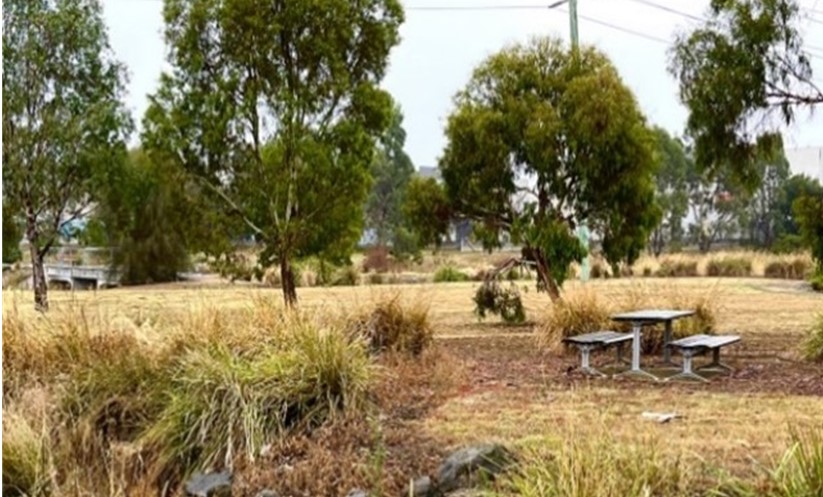
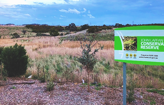
7.6 ha John Laffan Reserve is used by community groups for its sports ovals and pavilion.
The reserve is the site of the confluence of Merri Creek and Kalkallo Creek and connects public land extending south along the west side of Merri Creek. The conservation area in the reserve includes rocky escarpments and outcrops, grasslands, and remnant riparian vegetation including large, old trees with hollows that provide habitat for native animals. It is an area of cultural significance for the Wurundjeri Woi‑wurrung people.
A pedestrian bridge from the east side of Merri Creek will connect to the south-eastern corner of the reserve. The size of and facilities at the reserve are likely to change in the long term, due to the future duplication of Donnybrook Road, and the development of new, larger sporting facilities nearby.
The Merri Creek Management Committee has been central in the protection and restoration of biodiversity in the southern part of the reserve.
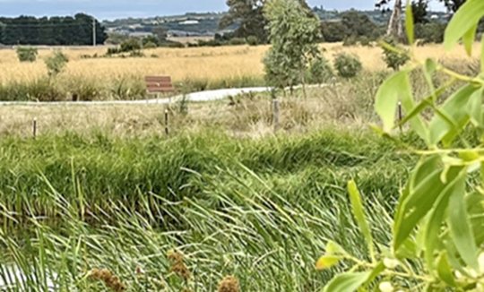
The 3 ha Bells Avenue Wetlands reserve is located off Moxham Drive in Kalkallo, just west of Merri Creek. It was created as part of the adjacent housing development.
The wetlands help to remove pollutants from stormwater from local streets and provide habitat for birds and aquatic life. Visitors can relax while walking around the wetlands and enjoy the children’s play space at the adjacent Quill Reserve.
The wetlands are set within the Growling Grass Frog conservation area.
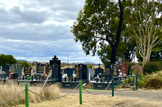
Donnybrook (also known as Kalkallo) Cemetery is found on Malcolm Street at Kalkallo. Established in the late 1890s, it provides an opportunity to explore remnants of local colonial history.
Surrounding Donnybrook Cemetery on the northern, eastern, and southern sides are remnant volcanic plain grasslands known as the Kalkallo Commons Grasslands. The sites supply a critical conservation area for the Gilgai Plains Grasslands, which is nationally and regionally significant. The northern part of the Grasslands can be viewed from Donnybrook Cemetery. Public access is limited to protect the key area for habitat and conservation.
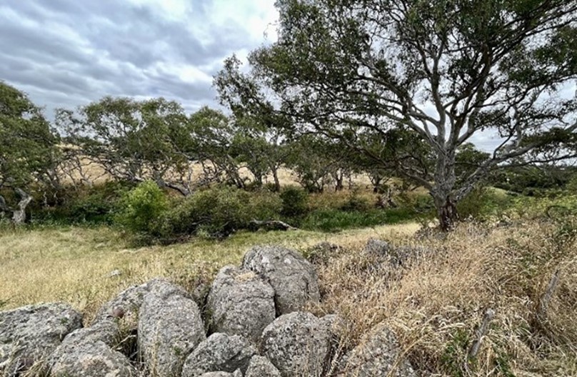
South of the cemetery are the stony knoll grasslands, which show the rocky outcrops created by the volcanic activity that has shaped the Parkland landscape.
Porto Kallo Park is located on Nature Promenade in Donnybrook and is adjacent to the Porto Kallo wetlands (a stormwater treatment wetland). The Park features a large playground for family recreation and provides a link to the Merri Creek corridor with views of Bald Hill in the distance.