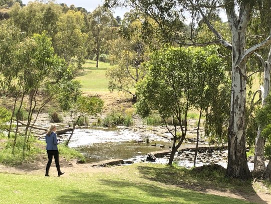
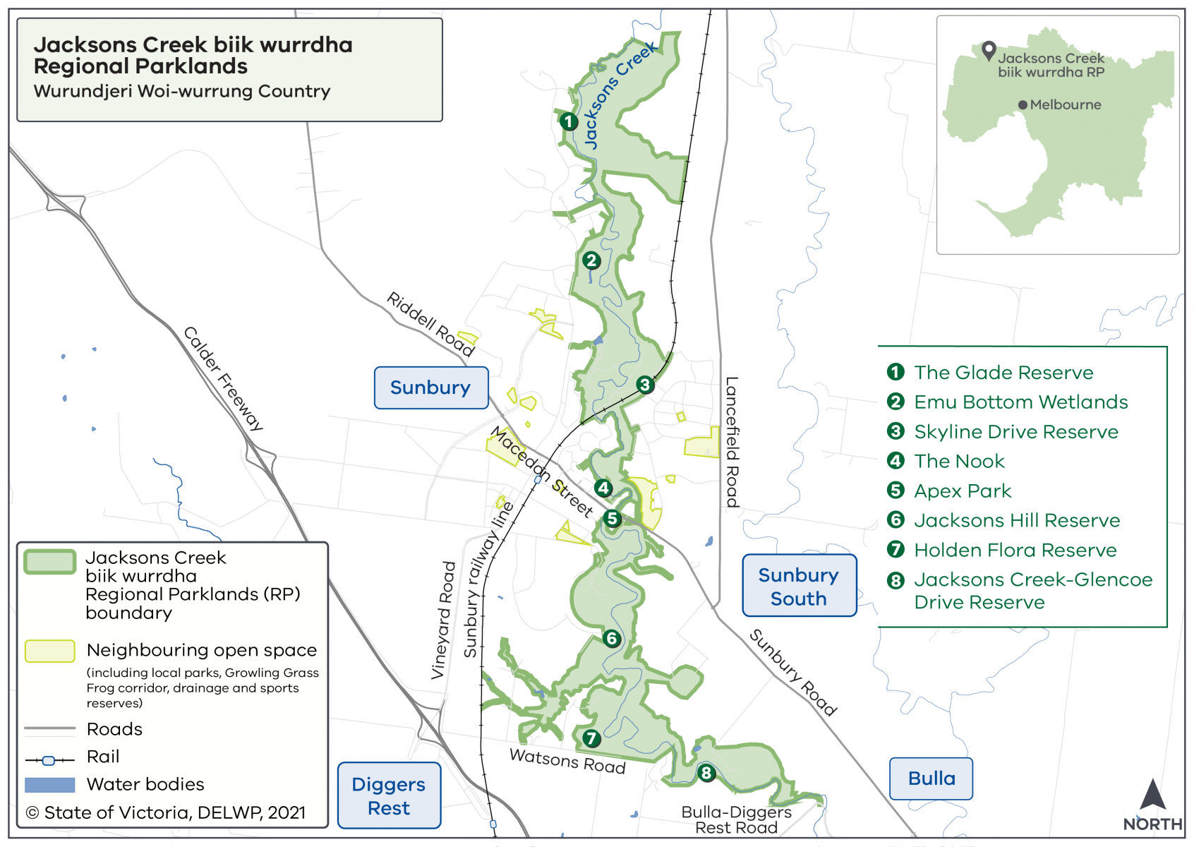
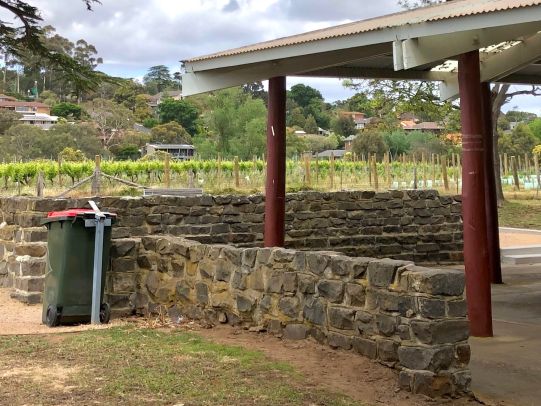
Visit The Nook to enjoy a picnic under the shady trees while watching birdlife and enjoying the creek edge. Toilet facilities and car parking are available.
Hume City Council manages The Nook
Jacksons Creek biik wurrdha Regional Parklands will span over 1,000 hectares and stretch along 26 kilometres of Jacksons Creek from Sunbury to Diggers Rest.
The name ‘biik wurrdha’ means ‘land of many’ and is the name given to Jacksons Creek by the Traditional Owners of the land, the Wurundjeri Woi-wurrung
Making green, open spaces more accessible and protecting plants and animals, including the platypus.
The parklands are being protected for conservation and cultural reasons, and DEECA is working with parkland partners to realise the vision in the Jacksons Creek biik wurrdha Parklands Plan 2022 (PDF, 12.2 MB)
Some areas of the parklands are not accessible to the public due to conservation and cultural sensitivities. You can now enjoy the parkland areas listed below.
Visit The Nook to enjoy a picnic under the shady trees while watching birdlife and enjoying the creek edge. Toilet facilities and car parking are available.
Hume City Council manages The Nook
Visit Emu Bottom Wetlands to see the new habitat restoration works, or maybe even see a platypus.
Watch the video to learn about the flora and fauna at Emu Bottom Wetlands.
Get directions to Emu Bottom Wetlands.
Hume City Council manages Emu Bottom Wetlands
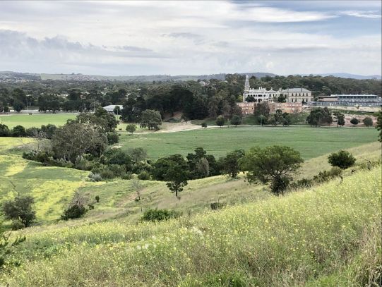
Walk along Skyline Drive Reserve to enjoy views over the valley including the historic Rupertswood Mansion. Kids will enjoy the playground.
Get directions to Skyline Drive Reserve
Hume City Council manages Skyline Drive Reserve
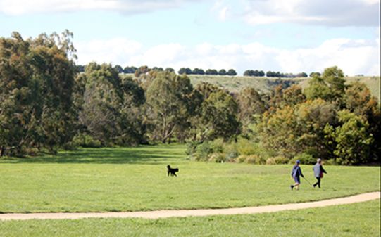
Visit Apex Park to enjoy the playground, bocce court and picnic facilities.
Visitors can usually walk down to the creek to view the historic bluestone bridge and walk to The Nook, however, due to Sunbury Road upgrades this access will be temporarily closed until March 2024.
Hume City Council manages Apex Park
Visit Jacksons Hill Reserve and enjoy the all-abilities path down the valley. View the historic mill while listening to the creek flow. At sunset, enjoy the colours of the red cliffs on the other side of the creek.
Get directions to Jacksons Hill Reserve
Hume City Council manages Jacksons Hill Reserve.
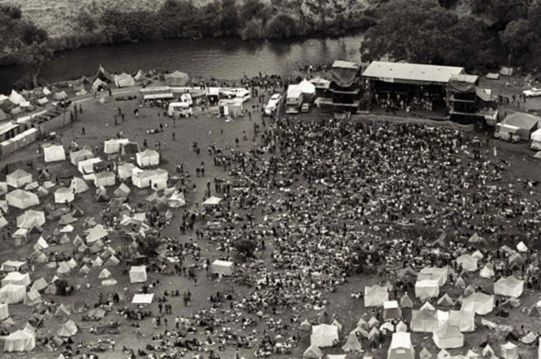
Glencoe Drive Reserve was the home of the iconic Sunbury Music Festival held on the banks of Jacksons Creek from 1972 to 1975.
In the coming years, this site will be accessible to visitors.
Watch the video to learn more about the history of the site and the Sunbury Music Festival.
Get directions to Glencoe Drive Reserve
Hume City Council manages Glencoe Drive Reserve
November 2018
2019 to 2022
October 2021
November 2021
March - April 2022
September 2022
Open in stages from 2024
We are working in partnership with Traditional Owners, public land managers, stakeholders and the community to develop the vision for the parklands.
The parklands will be managed by multiple land managers, known as parkland partners including:
For more information view resources below:
Page last updated: 01/03/24